Arizona
a territory of the United States. It is situated on the Mexican border, between New Mexico and California. In shape it approaches a rectangle. Land area, 112,920 square miles. The name is Spanish, meaning arid zone. There are but 100 square miles of water in Arizona. The mountains of Mexico trend northward through the territory, throwing off a number of short, steep spurs. Humphrey Peak, near Flagstaff, is the highest point. It rises to a height of 12,794 feet. The northern part of the territory is a vast, waterless plateau from 5,000 to 8,000 feet high. It carries numerous mountain spurs and is cut by deep canons. The Grand Canon of the Colorado lies in this section. Farther south, the surface drops off to a sandy plain, little above sea level. The entire surface is drained into the Gulf of California, which at one time is thought to have extended much farther inland, and to have occupied in part the plain now traversed by the Gila River. Owing to lack of rain, the Colorado, fed by snowcapped peaks farther north, is the only permanent river. A large part of the surface is without soil. The rocky torrents swell in time of rain, and then run dry. The Gila shrinks to a mere chain of brackish pools. The upper plateau has an annual rainfall of about twenty inches; the lower plain, five inches. The average temperature of the former is forty-nine degrees; of the latter, sixty-nine degrees. There are but two seasons, a short rainy season in midsummer and a dry one the rest of the year. A region around Fort Gila, at the mouth of the Gila, is the hottest part of the United States. The thermometer rises occasionally to 120deg. in the shade. On the upper plateau, parching days and cool nights are the rule. The dryness and clearness of the atmosphere render it a desirable region for invalids.
MINERALS. Arizona is crossed from east to west by two trunk lines of railway, the Atchison and Santa Fe, and the Southern Pacific. A branch of the latter connects the two systems. No section of the Union is richer in minerals. It is next to Michigan and Montana in the production of copper. Gold and silver mines, opened by the ancient Aztecs, are still worked. There are also workable mines of lead, and small seams of coal. Iron, tin, nickel, platinum, mercury, borax, salt, gypsum, and sulphur are found. The larger part of the territory is as yet little known. Although prospectors are supposed to have examined every turn and canon, it is believed that vast mineral wealth remains to be discovered. A marvelous petrified forest has been found in Navajo County, near Holbrook. Entire tree trunks of a yard in diameter have been turned into stone, and have cracked into cylindrical blocks of exquisite coloring. Fine specimens of opals, garnets, chalcedony, sapphire, and turquoise are found. Onyx is sawed into slabs for table tops.
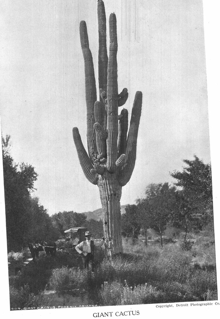
PRODUCTS. Certain regions toward the north have an abundant growth of bunch grass and mesquite, or buffalo grass, on which cattle are pastured the year around. A large part of the surface consists of alkali plains, thinly covered wth sage brush, grease wood, agave, yucca, and cactus. The cottonwood grows along the edge of streams. It is estimated that about one-fourteenth of the state may ultimately be brought under intensive cultivation by means of irrigation. In 1905 there were about 254,000 acres under crop. Plans are under foot to create huge mountain reservoirs, in which the water that now runs away through the Salt, Gila, and Colorado in an annual flood may be held and doled out during the long dry season for purposes of irrigation. The soil is naturally rich. It is believed that Arizona has a great future in the production of semi-tropical fruits, such as apricots, lemons, oranges, raisins, grapes, almonds, figs, and dates. The United States Department of Agriculture is experimenting with dates at Tempe and Yuma. Egyptian cotton and mulberry trees seem to thrive. It is quite possible that Arizona may prove to be the silk producing region of the United States. The irrigated lands are devoted largely to the production of alfalfa. Several crops are produced yearly. The upper plateau has also its wooded regions, in which the mountain sides are clothed with pine, cedar, and juniper.
HISTORY. Arizona was visited by the Spaniards in 1539. In the following year, Coronado led an expedition to the settlements of the Moqui and Zunis. He found the remains of ancient cities, aqueducts, and temples, indicating that the region was at one time the home of some prehistoric race, familiar, like the Aztecs, with the art of building. Aztec legends locate the "Seven Cities of Cibola" here. In 1560 Tucson was founded by the Spaniards. Citizens assert that it is an older town than St. Augustine, Florida. The region was acquired from Mexico by treaty in 1848. A strip south of the Gila formed, however, a part of the Gadsden Purchase, made in 1853.
Arizona was organized as a territory February 24, 1863. Settlement has been retarded greatly by the Apaches and the Navajos, whose frequent uprisings and midnight raids deterred even the boldest stockraisers and traders from leaving the shelter of garrisons. There are thirteen counties.
EDUCATION. Every effort has been made to provide schools for the scattered children of the commonwealth. According to the last census, over seventy-five per cent of the children between five and seventeen years of age were in actual attendance at school, a record which states much more favorably situated have not equaled. A territorial university was opened in 1901 at Tucson. The largest town in the state is Tucson. It had 5,100 inhabitants in 1900. Phoenix is the capital. Next in order of size are Prescott and Jerome. At Flagstaff, on the Santa Fe, the university has established an astronomical observatory. The population of the territory in 1900 was 122,931. Of this number 26,480 were Indians, living on five reservations. They have for the most part settled down to stock raising. Several schools have been established for their benefit. There are also about 25,000 Mexicans and 2,000 Chinese. The Mormons are the strongest religious denomination of the territory. Next in number are the Roman Catholics.
STATISTICS. The following statistics are the latest to be had from trustworthy sources:
| Land area, square miles | 112,920 |
| Population (est. 1906) | 143,745 |
| Phoenix | 7,000 |
| Tucson | 6,000 |
| No. counties | 13 |
| Members of state senate | 12 |
| Representatives | 24 |
| Salary of governor | $3,000 |
| U. S. representatives (territorial) | 1 |
| Presidential electors | 0 |
| Value of mines (not taxed) | $100,000,000 |
| Assessed valuation of property | $80,637,541 |
| Bonded indebtedness | $1,012,972 |
| Acres irrigated | 210,000 |
| Agricultural Products- | |
| Corn, bushels | 430,000 |
| Wheat, bushels | 400,000 |
| Oats, bushels | 144,000 |
| Hay, tons | 330,000 |
| Domestic Animals-- | |
| Horses | 101,000 |
| Mules | 4,000 |
| Milk cows | 23,000 |
| Other cattle | 603,000 |
| Sheep | 1,031,000 |
| Goats | 250,000 |
| Swine | 18,000 |
| Miles of railway | 1,882 |
| Capital invested in manufacturing. | $14,395,000 |
| Operatives | 4,793 |
| Raw material | $14,595,000 |
| Output of manufactured goods | $28,083,192 |
| Silver output | $1,916,000 |
| Gold output | $2,664,000 |
| Copper ore output (pounds) | 256,000,000 |
| Quarry products | $237,000 |
| Teachers in public schools | 645 |
| Pupils enrolled | 26,314 |
| Average no. of days attended by each pupil | 78 |
| Percentage of male teachers | 17 |
| Average monthly salary of men teachers | $99.50 |
| Average monthly salary of women teachers | 75.06 |
| Av. annual expenditure per pupil | 40.41 |
See United States; New Mexico; Irrigation; Apaches; Sunshine; Alkali; Colorado Canyon; Cactus