Co-ordinate SystemsNavigation
There are two--the polar and rectilinear.
Page 352 of Patterson’s Illustrated Nautical Encyclopedia · 25 entries
There are two--the polar and rectilinear.
The true system of the universe, which represents the sun to be at rest in the centre, and the planets to move round it in ellipses.
The true geographical angle that the ship has sailed, found by applying the leeway, deviation and variation to the course sailed by compass.
(See Logarithms.)
(See Logarithms.)
(See Logarithms.)
The angle which a ship's keel makes with the meridian when she is sailing.
The bearing of the vessel from the point left.
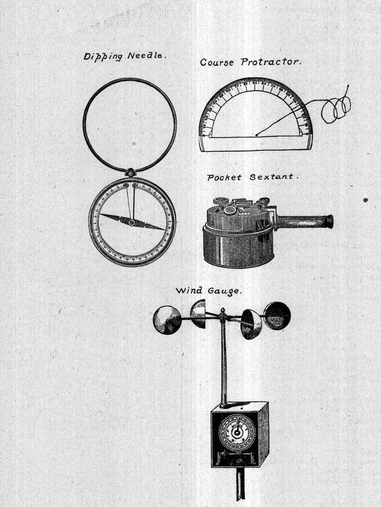
A graduated rule or half-circle employed in shaping the course.
Bearings of two or more objects observed from the same point. The intersection of these lines of bearing is the place of the observer. They are very valuable for locating the position of the vessel when on the coast.
A method of regulating a watch at sea by observing right and left altitudes of heavenly bodies with a circle of reflection.
The very fine wires placed in the focus of the object-glass of a telescope.
A heavenly body is said to culminate when it crosses the meridian.
Upper Culmination. When a heavenly body crosses the meridian above the pole.
Lower Culmination. When a heavenly body crosses the meridian below the pole.
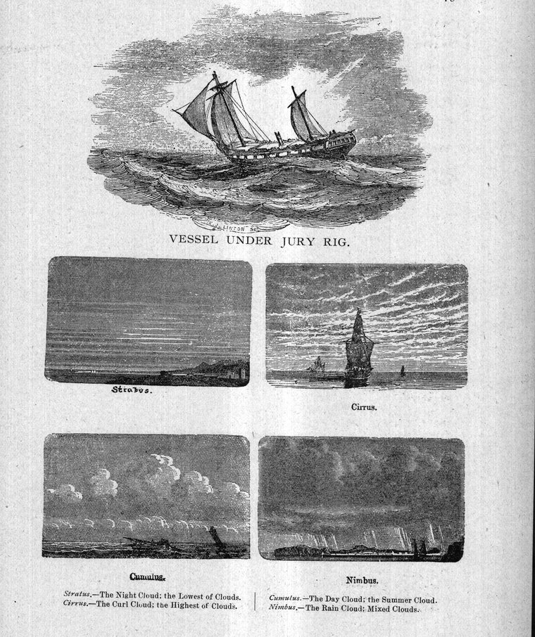
A mixed system of clouds. Also known as Nimbus, the rain cloud.
A blending of cumulus and stratus.
Known as the summer cloud. A species of cloud assuming more or less of a conical figure.
A current may be defined as a progressive motion of the water of the sea at certain places.
(See Ground Log.)
When a vessel sails through a sea in which a current is experienced its effect will be to set the ship in the direction of its flow, and this is considered as an extra course, and the rate of the current the velocity of the vessel on such course, and this course and distance will be entered regularly in the traverse table.
A revolution or round of time within which events recur in the same order. Cycle of the Sun. Also known as the solar cycle. A period of 28 years, after which the same days of the week recur on the same days of the year.
Also known as the metonic cycle. A period of 19 solar years, after which the new and full moons fall on the same days of the year as they did 19 years before. This is sometimes referred to as the golden number.
A period of 6,586 days--the time of revolution of the moon's node.
A curve traced out by any point in the plane of a circle rolled along a straight line.
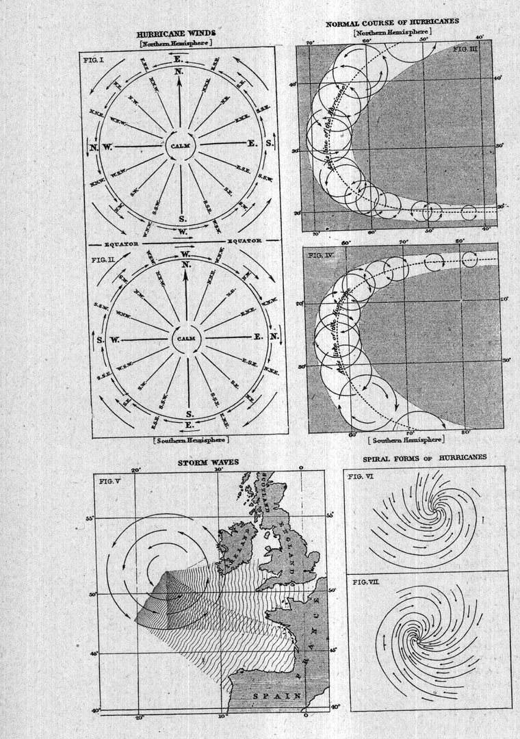
A revolving wind advancing on a line.
These are of two classes, namely, vertical and horizontal. In the former, the offshore distance of the danger is measured with the dividers and this quantity together with the height of the light-house (or hill, etc.), is compared in the distance tables and the angle selected, which will be found given in degrees and minutes. In the horizontal danger angle two prominent objects shown on the chart are selected and a pencil dot is made on the chart seawards of the reer, rock or other danger. A circle is swept with the pencil compasses through the three points. The pencil dot is next connected with the two objects on shore by straight lines and this angle measured by the parallel rules and by the diagram compasses printed on the chart. This angle will be found to be the same at any point of the circumference of the circle. In both the vertical and horizontal angles, so long as the navigator does not allow the angle to increase he will navigate in safety outside of the danger.