GlassNavigation
A general name for the barometer, telescope and sand glass.
Page 366 of Patterson’s Illustrated Nautical Encyclopedia · 39 entries
A general name for the barometer, telescope and sand glass.
A great circle chart, constructed by one Godfrey, making simple the operation of laying down the great circle track.
The moon's cycle is a period of 19 solar years, and after that the new and full moon occurs the same day of the year as 19 years before. The golden number shows the years of the moon's cycle, reckoning from 1 to 19.
The scale on the arc of an instrument of reflection.
The ordinary parallel ruler having one of its edges divided into degrees, and the other edge in points, half points, and quarter-points. It facilitates the shaping of the ship's course, being independent of the diagram compasses.
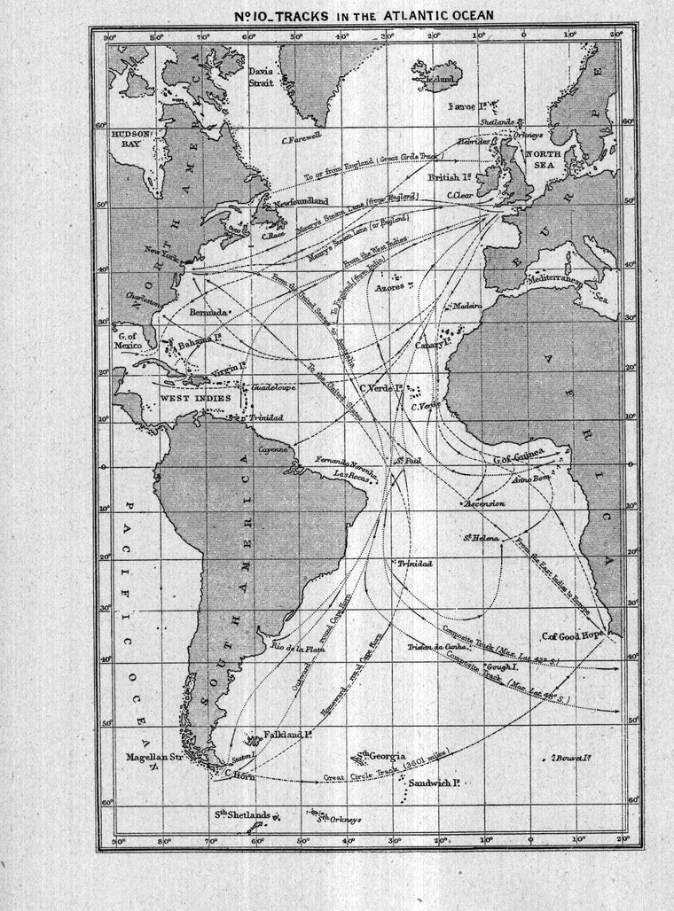
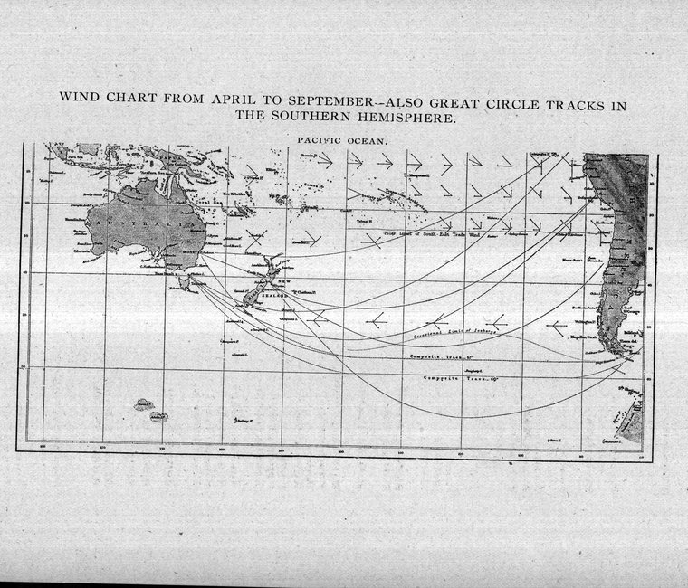
The arc of a great circle is the true course between two places, and the length of the track is the shortest distance between them. When a great circle track is drawn on a Mercator's chart it represents a curve, except on the equator and on north and south courses. A ship sailing on a great circle would be constantly changing the direction of her head, according to the curve represented on a Mercator's chart, while in reality she would sail in a direct line from place to place. This may be explained by stating that a Mercator's chart is distorted, and that which appears to be a straight line connecting two places is in reality a curve, and that the represented curve of a great circle is a straight line.
Used by navigators for laying out great circle tracks. It is constructed on the Central or Gnomonic projection, all great circles appearing on it as straight lines.
The act of sailing upon an arc of the great circle.
The date for the meridian of Greenwich, either civil or astronomical.
The civil time for Greenwich represented on board ship by the chronometer regulated to the mean time of that meridian.
This instrument consists of a lead made fast to the regular chip log-line and cast overboard, and is used in shoal water when the vessel is drifting under the influence of a tide or current-no objects being visible whereby to fix the ship's position. The angle made by the line will give the set of the vessel, and the rate will be measured by the seconds glass, as usual.
An Atlantic current. The trade winds blow the warm waters of the tropics into the Caribbean Sea and Gulf of Mexico, from whence they are poured out through the Straits of Florida, expanding as they flow to the northward from 40 to 300 miles, and following the curve of the United States coast.
A chain employed in land surveying. It is 66 feet or four poles in length.
A scale on which numbers are laid down opposite their logarithms, and used for performing the operations of multiplication and division of numbers mechanically.
A flat rule two feet in length, having marked on one side scales of equal parts, chords, tangents, sines, etc. On the other side are marked logarithms of these respective parts, and by the employment of which problems in navigation and surveying may be performed mechanically.
An astronomical instrument for finding the hour of the day.
The middle of the tide.
A sand-glass used in logging the ship.
A chart showing the variations of the compass by a series of curves.
A circle or bright ring about the sun or moon-in the first place termed solar halo, and in the latter lunar halo.
A tell-tale compass.
(See Celestial Sphere.)
Determining the ship's rate of speed through the water by means of the log and line and seconds glass.
The alteration of compass deviation owing to the vessel being off an even keel.
Same as heeling deviation.
The angle of a heavenly body above the horizon; the level of high water; the distance in feet from the hollow of a sea to the crest.
A star rises heliocally when it is first visible in the morning after it has been hidden by the sun's light, and it is said to set heliocally when first lost in the twilight owing to the light of the sun.
In relation to the sun's centre.
The point in which a planet would appear if viewed from the centre of the sun.
An instrument made use of for measuring the diameters of the sun, moon and planets.
An instrument which reflects the sun's rays by a mirror, and used in trigonometrical surveys. Also known as Heliotrope.
(See Heliostat.)
Half of a globe; half of the heavens.
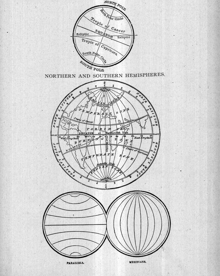
Parallels far from the equator, and approaching the poles.
The greatest elevation of the flood tide.
Same as high tide.
The mark made on the shore by the tide at the point of its greatest height.
An old fashion nautical instrument of reflection used in 1570.
The line of the blending of earth (or sea) and sky; the apparent meeting of the earth and heaven.
Apparent Horizon. (See Visible Horizon.)
Artificial Horizon. A reflector of quicksilver placed on the ground and used for observing altitudes of the heavenly bodies.
Celestial Horizon. The great circle in which the planes of the sensible and rational horizons produced cut the celestial sphere.
Dip of the Horizon. The angle between the visible and sensible horizons.
Rational Horizon. An imaginary great circle, the plane of which passes through the earth's centre, the poles being the zenith and nadir, and which divides the globe into two equal parts--parallel with the sensible horizon.
Sea Horizon. The circle which bounds the view of the observer--the apparent meeting of sea and sky.
Sensible Horizon. A plane touching the earth at the point where the observer is situated, and which meets the celestial sphere in a circle.
Shore Horizon. When the sea horizon is hidden by the intervention of land, the beach line is known as the shore horizon.
Visible Horizon. When the observer is elevated above the earth's surface by ordinary height of eye, or by standing on a vessel's deck, the limit of view is termed the visible or apparent horizon, and the angle between the visible and sensible horizons is called the dip of the horizon.